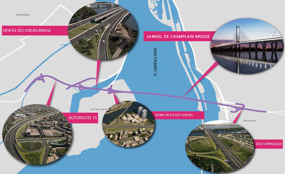
Samuel De Champlain Bridge - Aerial image of the Samuel De Champlain Bridge

Text description
Aerial project overview showing the trajectory of the Samuel De Champlain bridge. The locations of the new Île-des-Soeurs bridge, the reconstruction and widening of Autoroute 15, work on Île-des-Soeurs, and the east approach in Brossard are identified. The St. Lawrence River is also identified, along with Montréal and Brossard.
- Date modified: